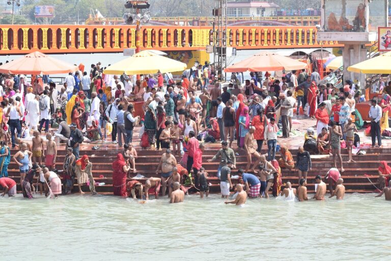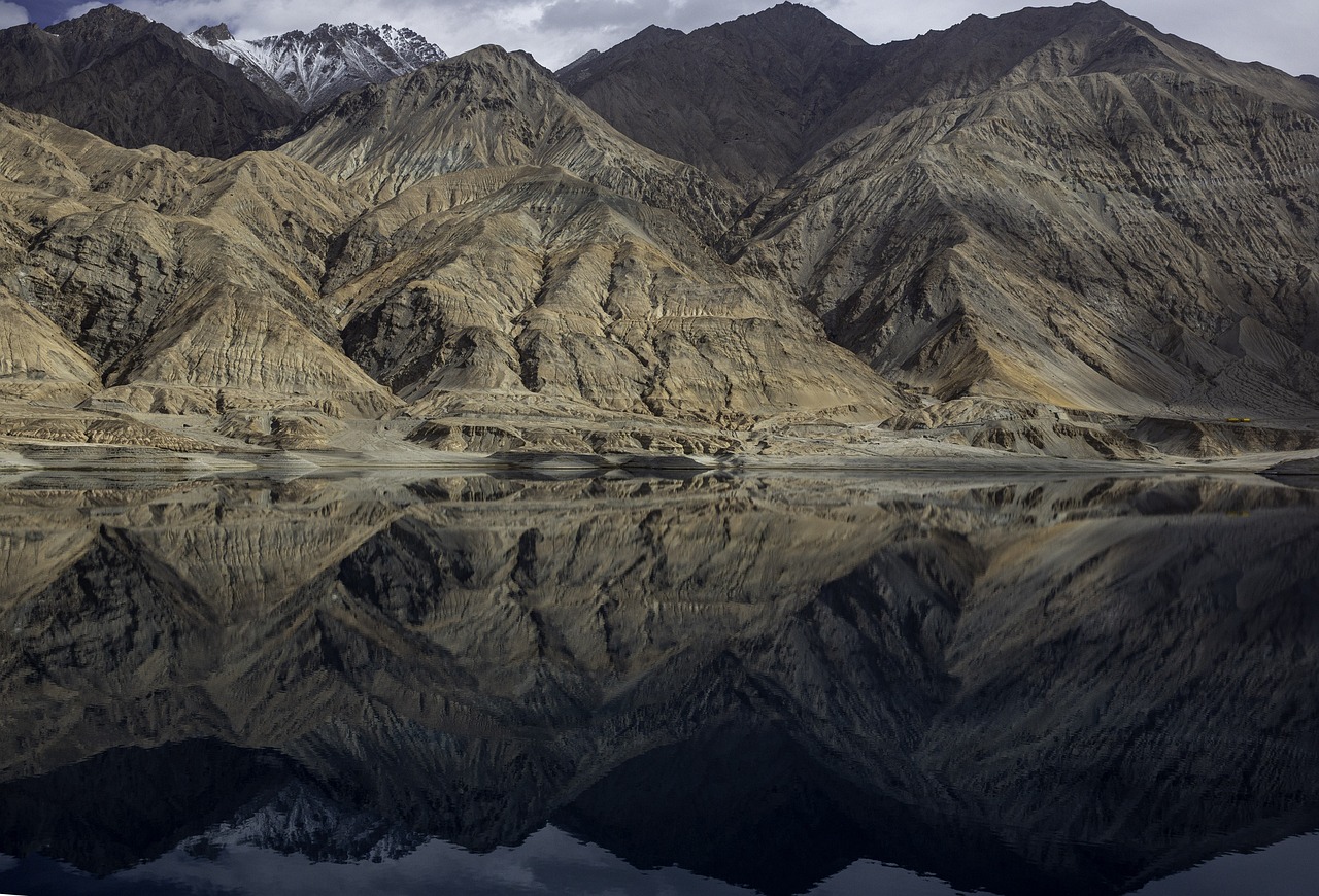
Pamir Mountains in Tajikistan. The Pamir Mountains host many glaciers, including the 77 km (48 miles) long Fedchenko Glacier, the longest in the former USSR and outside polar regions. About 12,500 km², or 10%, of the Pamirs is glaciated. In the Southern Pamirs, glaciers are melting rapidly, contributing around 10% of the annual runoff.
World Water Day March 22: Why is Tajikistan concerned?


By Dr Indira Khurana* and Ashok Khurana**
Are the melting glaciers of Tajikistan representational of challenges the world will face due to climate change?
In June 2024 the authors travelled to Tajikistan via Uzbekistan to understand the situation of melting glaciers and how this accelerated melting is affecting the country and the region.
The Republic of Tajikistan is a young country with a population of 10 million, which emerged after the dissolution of the USSR in 1991. It is the smallest of the five Central Asian countries that were formed. The country is landlocked, surrounded by China in the East, Uzbekistan in the West, Kyrgyzstan in the North and Afghanistan in the South. It is also the poorest member of the Commonwealth of Independent States (CIS) and despite considerable income growth ranks 125 out of 189 in the Human Development Index (UNDP, 2019). The economy remains heavily dependent on Tajik labour migrants, whose remittances contributed around 30 per cent of GDP in 2019; making Tajikistan one of the most remittance-dependent countries in the world.
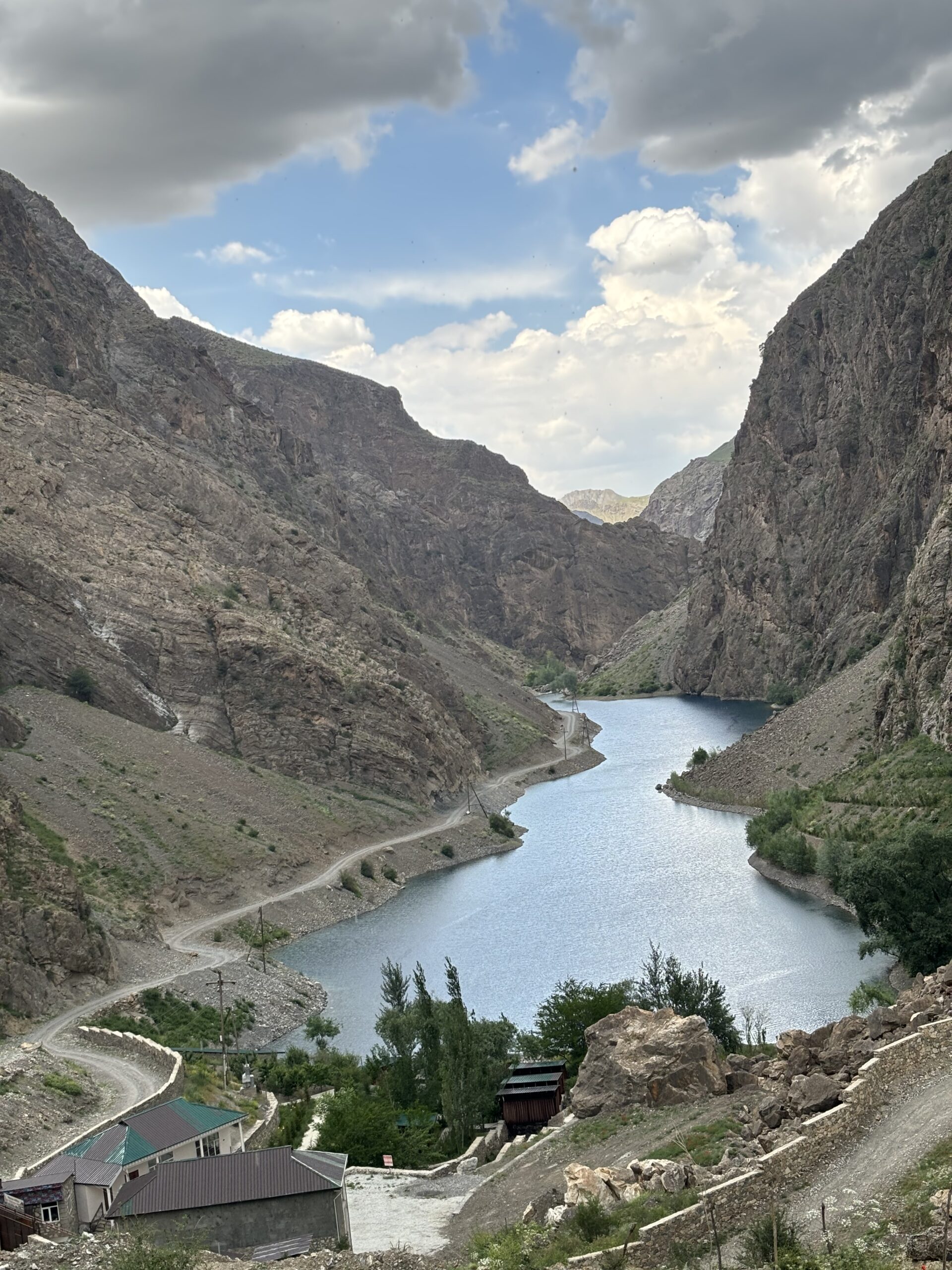
A major part of this beautiful country is mountainous – almost 93 per cent. The Pamir mountain ranges and the Alay mountain ranges are the source of many glacial-fed streams and rivers that have supported agriculture and other water needs since ancient times. Three mountain chains are found in the lower mountainous region – The Turkestan, Zarafshan, and Hisar mountains. These mountains too are the source of several glacial-fed streams and rivers. The Fann mountains are part of the Pamir-Alay mountain ranges and are home to several beautiful lakes. There are 1,449 natural lakes in Tajikistan: Some 80 per cent of these lakes are located in mountainous and highland areas and are glacier-fed.
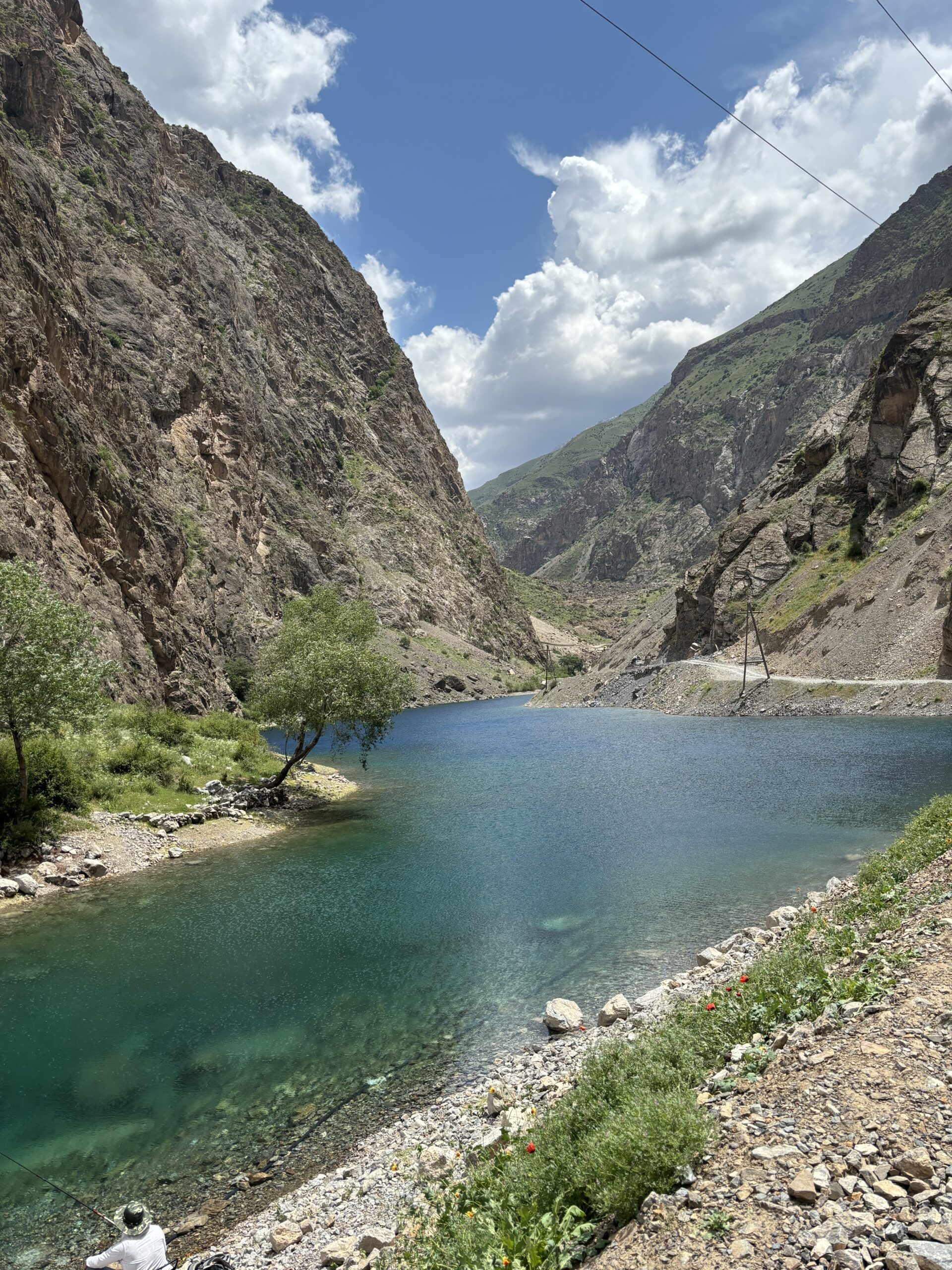
The seven lakes: One of Tajikistan’s best-kept secrets
In the west of Tajikistan, near the historic town of Penjikent, are the Haftkul or Seven Lakes. Each lake has its own name: The lowest and first lake, is Nezhigon, then Soya, Hushyor, Nofin, Khurdak, the largest Marguzor, and the last Hazorchashma.
How does one get to these lakes in Tajikistan? We undertook a two-hour drive from Samarkand and crossed over to Tajikistan. A short drive later we were in Penjikent and driving further, into the Zarafshan hills. The Zarafshan district, which lies in north-western Tajikistan’s Sughd province, encompasses the Zarafshan river valley and the Fann mountain range.
Travelling to these lakes and taking in the beauty, one wonders: How will these lakes be affected by climate change, given that the water in these lakes comes from the flow of rivers which in turn are glacier-fed?

If the Fann mountains are Tajikistan’s crown, then the seven lakes are the diamond necklace that are adorning it. These lakes are located in the Shing River gorge. The height of the lowest lake is 1,640 metres, and the highest is 2,400 metres above sea level.
All lakes, except for the last or seventh lake Hazorchashma, belong to the blockage type of lakes and appeared due to the descent of rock in a narrow gorge. Their natural dams were formed millions of years ago because of earthquakes and mudstone flows during glacier melting. Each of the lakes is connected by the waters of a turbulent mountain river that amazes with its beauty and purity. Ancient petroglyphs found on the shore of one of them also indicate that the lakes are quite old. Petroglyphs are rock carvings (rock paintings are called pictographs) made by pecking directly on the rock surface using a stone chisel and a hammerstone and are images created by removing part of a rock surface by incising, picking, carving, or abrading, as a form of rock art.
Each of the seven lakes has its own name and distinct features. Nezhigon meaning ‘eyelashes’, is the first lake to be seen, at a height of 1,640 metres and with a depth of 20 metres and an area of 0.05 square kilometres. The lake is well known for its changing colours, depending on the season and the time of day you visit, and ranges from turquoise, deep blue to even purple. This is due to the high mineral content (Sodium and Calcium) in the water. Why this lake was named thus remains a mystery, although some suggest its gently curved shape may have been the inspiration.
The names of the remaining six lakes can clearly be tied to their unique attributes. Continuing upwards from Nezhigon, up the serpentine road, is a natural dam that separates Nezhigon from Soya Lake. Soya, meaning ‘shadow’ in Tajik, is aptly named given how it is found between high cliff and remains in the shadows for most of the day. The lake is at a height of 1,701 m, with an area of 0.1 square kilometres.
Driving up around 400 metres from this lake is Lake Hushyor, meaning ‘watchful or vigilant’, at a height of 1,771 m and an area of 0.23 square kilometres. Surrounded by steep cliffs this lake was once home to poisonous snakes. In Soviet times, a campsite for the Seven Lakes was located near this lake, which was destroyed by a landslide, leaving behind remnants. In good weather, schools of fish swimming can be spotted.
Driving further up the mountains is Lake Nofin at a height of 1,820 m, an elongated lake with a length of 2.5 km, a width of 200 m, and an area of 0.48 square kilometres. Norfin refers to ‘umbilical cord’ in Tajik, and maybe this lake is so named because of its elongated nature and it is the middle of the seven lakes.
Khurdak (Baby) is the smallest of the seven lakes that can be circled in just a few minutes. having an area of 0.25 square kilometres, at a height of 1,870 metres and 1.5 kilometres away from Norfin, the previous lake.
The sixth lake, Marghzor Lake is perhaps the most beautiful of all and can be reached by an upward drive of 2 km from Khudrak and at a height of 2,140 metres, with a surface area of 1.16 square kilometres and a depth of 45 metres. The expanse of jade-blue water and the majestic mountains create a magnificent landscape.
Hazorchashma, the highest of the seven lakes is at a height of 2,400 metres, and is the second largest of the lakes, with a length of 2 square kilometres and an area of 0.92 square kilometres. The lake derives its name from ‘Hazor’ meaning thousand and chashma, meaning ‘spring,’ literally translating into ‘thousand springs’ This is the last of the Seven Lakes in the Shing River gorge.
Interestingly, petroglyphs were discovered near Lake Marguzor, and during the Middle Ages, semi-precious metals were mined here. Mountain villages perched near Lakes Khurdak and Marguzor provide a glimpse into the present-day lifestyle of rural Tajik families, where mysterious folklore surrounding the lakes remains alive and palpable.
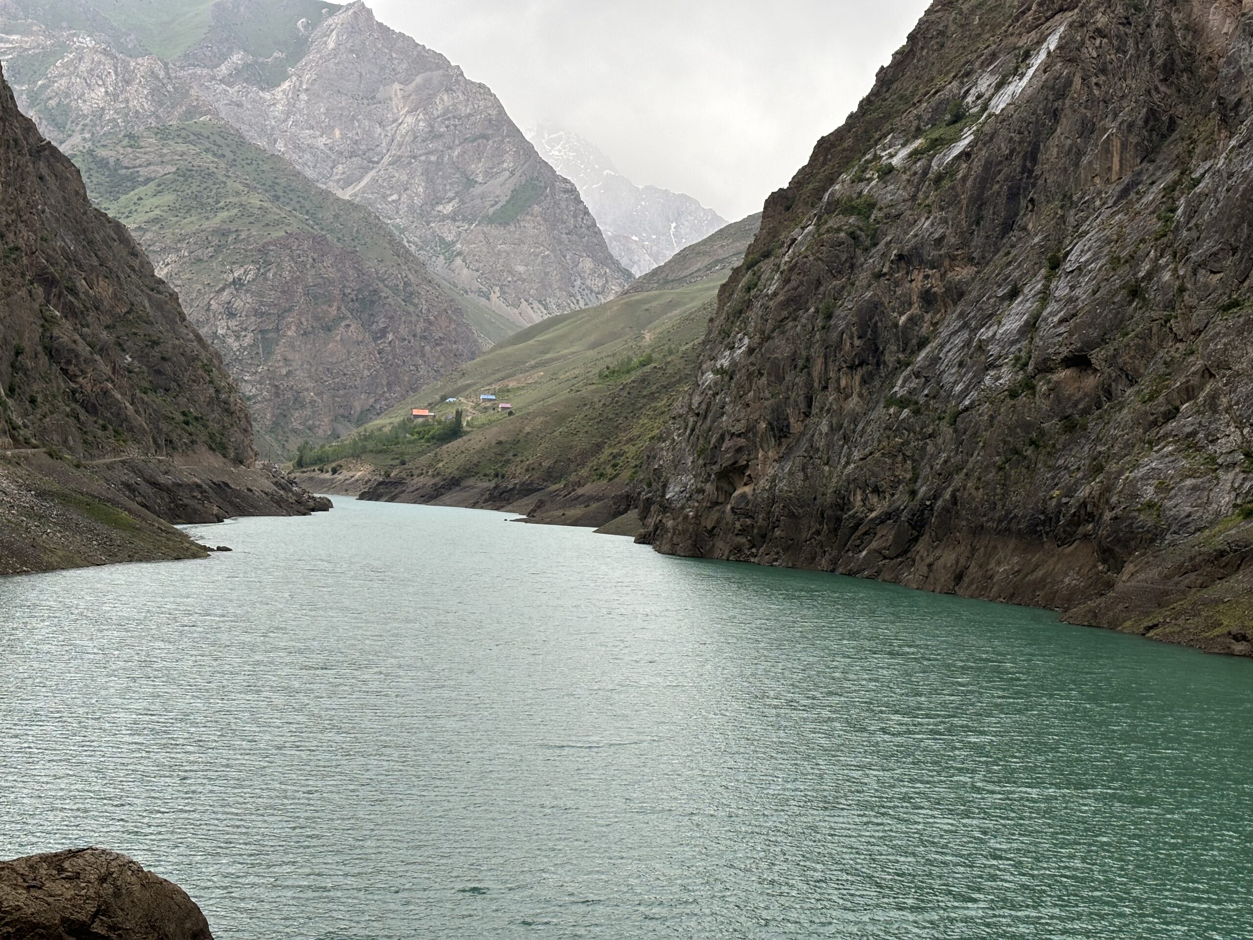
Our research and interaction with the Tajiks help us understand the seriousness of the problem. Almost six per cent of Central Asian waters originate from the glaciers and snow reserves of Tajikistan. Up to 500 cubic kilometres of water are accumulated in the glaciers and snows of this country. Climate change is causing rapid glacier melting in the mountainous regions here. In a meeting at the Wilson Centre in Washington, Tajikistan’s ambassador shared that more than 1,000 of the 30,000 glaciers in his country have already melted. By 2050, this figure may drop by a third, which threatens flash floods from bursting ice lakes, and subsequent water scarcity.
Every year the country suffers from floods, avalanches and other water-related disasters. The mountainous regions of the country generate 98 per cent of the electricity through hydropower and so this situation is a point of concern on several levels.
Melting of glaciers in Tajikistan will lead to irreversible climate changes in Central Asia, desertification, agricultural crisis, decline of entire regions due to water shortage, complete destruction of the Aral Sea and may lead to a huge crisis due to water and food shortages due to reduced harvests. The main consumer of water in Tajikistan is irrigated agriculture, varying from 85 to 90 per cent of the total volume of water used. Irrigated agriculture is strategically important for food security and the economy since it provides up to 90 per cent of agricultural production and contributes about 20 per cent of the national GDP, ensuring employment for the rural population, which constitutes more than 70 per cent of the total population.
As glaciers continue to melt here, implications include changes in river flows, water availability, increase in disasters such as avalanches and landslides, floods and drought, with heightened threats to lives, livelihoods and infrastructure. The scattered settlements in the mountains may find their streams drying up.
In a 2020 blog, World Bank’s Lilia Burunciuc shared that Tajikistan’s annual economic losses due to floods and earthquakes amount to 400 million dollars and affect 500, 000 people. Central Asian countries lose 10 billion dollars annually to natural disasters.
*Indira Khurana, PhD is Chief Advisor of Tarun Bharat Sangh, an NGO working since 1975 towards climate change mitigation and adaptation.
**Ashok Khurana is a retired Director-General of Central Public Works Department, Government of India