Rome: Geospatial data have shown the ongoing conflict has resulted in intensifying damage to the agricultural sector (cropland, greenhouse, agricultural infrastructure, agricultural wells, solar panels and others) in the Gaza Strip.
The latest assessment using satellite data produced by the Food and Agriculture Organization of the United Nations (FAO) and the United Nations Satellite Centre (UNOSAT) shows escalating damage to farmland and agricultural infrastructure there, further exacerbating the humanitarian and hunger crisis resulting from the ongoing conflict.
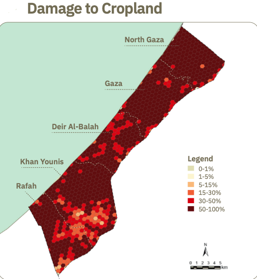
Out of Gaza’s 36,410 hectares, 42 per cent (15,053 hectares) is used for cropland. As of September 1, 2024, 67.6 per cent of Gaza’s cropland – or 10,183 hectares (ha) – has been damaged. This is up from 57.3 per cent (8,660 ha) in May and 42.6 per cent (6,694 ha) in February 2024. More specifically, 71.2 per cent of orchards and other trees, 67.1 per cent of field crops, and 58.5 per cent of vegetables have been damaged.
The satellite images indicate that heavy vehicle tracks, razing, shelling, and other conflict-related pressures have also significantly damaged Gaza’s agricultural infrastructure, with a total of 1,188 agricultural wells (52.5 per cent) and 577.9 ha of greenhouses (44.3 per cent) damaged.
“This satellite analysis provides critical insights to support humanitarian efforts as the conflict continues to impact Gaza’s agricultural sector,” UNITAR Executive Director Nikhil Seth said. UNOSAT is a specialized programme within UNITAR, the United Nations Institute for Training and Research.
“The extent of the damages on agricultural land in the Gaza Strip has reached unprecedented levels. This raises serious concerns about the potential for food production now and in the future, because food aid alone cannot meet the daily needs of Gaza’s people. This damage to agricultural land compounds the imminent risk of famine in the whole Gaza Strip,” FAO Deputy Director-General Beth Bechdol said.
More than 2 million Gazans are still in urgent need of food and livelihood assistance as humanitarian access remains restricted. The latest assessment, covering the period 7 October 2023 – 1 September 2024, reinforces concerns about the risk of famine.
Since the conflict started, FAO and UNOSAT have provided regular agricultural assessment updates, combining field and satellite data to evaluate various agricultural indicators, such as cropland area extent.
Assessment details of note
- Khan Younis has the largest area of damaged cropland (2 589 ha or 61.5 per cent), while North Gaza has the highest proportion of damage per governorate (78.2 per cent).
- The Port of Gaza City has been severely damaged, with most fishing boats destroyed.
- Rafah has seen a sharp increase (183 per cent) in damaged greenhouses, rising from 44 ha in April to 124.7 ha in September 2024, accounting for 27.7 per cent of its total greenhouses.
- Almost 95 per cent (about 15 000) of cattle have died, and nearly all calves have been slaughtered.
- Around 43 per cent of sheep (less than 25,000 heads) and 37 per cent of goats (about 3,000 heads) remain alive.
- Dramatic losses are reported in the poultry sector, with only 1 per cent (ca. 34,000) of heads alive. Commercial poultry production has largely ceased, with most operations now limited to household-level production for self-consumption.
The conflict has removed access to critical sources of protein and nutritious foods and continues to devastate peoples’ livelihoods.
Agricultural aid is urgently needed to restore the availability of highly nutritious food, prevent the agricultural sector’s total collapse, preserve remaining agricultural livelihoods, and curb acute hunger and malnutrition, especially among children. Gaza’s farmers, fishers, and herders are risking their lives to continue food production. However, this is becoming increasingly difficult due to the substantial infrastructure damage, as documented in the latest geospatial analyses.
Like other UN and humanitarian actors, FAO has experienced logistical challenges, particularly due to the restriction at crossings caused by the collapse of law and order that constrains the delivery of agricultural aid into Gaza. As of September 29, 2024, FAO said it distributed fodder to over 4,400 livestock holders in Rafah, Khan Younis, and Deir al-Balah and veterinary kits to about 2,400 herder families.
FAO added that it was ready to deliver more inputs to Gazan farmers and herders once access, security and mobility conditions were fully restored.
– global bihari bureau
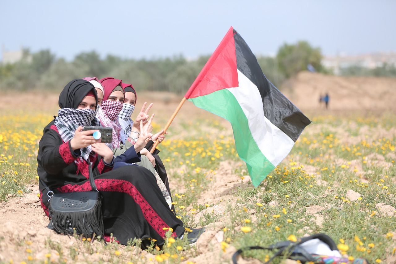
Top image of Gaza by hosny salah from Pixabay


