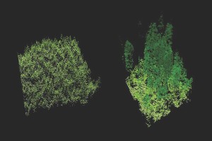
Using LIDAR to compare old-growth forest (right) to a new plantation of trees (left)*
New Delhi: Minister for Environment, Forest and Climate Change, Prakash Javadekar in a virtual event today released the Detailed Project Reports (DPRs) of LiDAR (Light Detection and Ranging) based survey of forest areas in ten states namely Assam, Bihar, Chhatisgarh, Goa, Jharkhand, Madhya Pradesh, Maharashtra, Manipur, Nagaland, and Tripura.
The project is a first of its kind experiment using LiDAR technology expected to help augment water and fodder in jungles areas thereby reducing human-animal conflict, help in groundwater recharge, help local communities. LiDAR, which stands for Light Detection and Ranging, is a remote sensing method that uses light in the form of a pulsed laser to measure ranges (variable distances) to the Earth.
Javadekar today asked state forest departments to use CAMPA funds towards implementation of these projects in right earnest and in accordance with the ‘Ridge to Valley’ approach of watershed management.
The project was awarded to WAPCOS, a PSU under the aegis of Ministry of Jal Shakti in July 2020 at a cost of Rs.18.38 crore for implementation in 26 states over 261897 hectare. The DPR’s for the remaining 16 states will also be released shortly, the Ministry of Environment, Forest and Climate Change stated.
WAPCOS prepared the Detailed Project Reports using LiDAR technology in which the 3-D (three dimensional) DEM (Digital Elevation Model), imagery and layers of the project areas are used for recommending different types of soil and water conservation structures such as Anicut, Gabion, Gully Plug, Mini percolation tank, Percolation Tank, Field bund, Sunken pond, Farm pond. These structures will help in catching the rain water and prevent stream run off, which will help in recharging of ground water.
WAPCOS with the participation of State Forest Departments identified one major ridge inside a forest block in these states with average area of 10,000 hectare selected in each State for preparation of Detailed Project Reports for planning and identifying locations and structures for construction of appropriate and feasible micro soil and water conservation structures consistent with site specific geography, topography and soil characteristics.
States/Union Territories identified one major ridge inside a forest block with the criteria that area selected should have average rainfall of the state, and the area requires assisted natural generation which means the density of forests should be less than 0.4 or below, but should have reasonable potential to regenerate with the ANR interventions.
(*This image was originally posted to Flickr by Oregon State University at https://flickr.com/photos/33247428@N08/25793001894)
– global bihari bureau


