NITI Aayog Maps India’s Urgent Water Imbalances
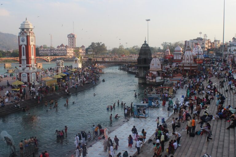
 New Delhi: Long before the numbers appear in spreadsheets, India’s water stress is felt in the curve of a dried spring-channel, in the echo inside a deepening well, and in the quiet anxiety that travels through a village when the first summer month arrives without the reassurance of flowing water. NITI Aayog’s latest water budgeting assessment, covering 18 aspirational blocks across the country, brings these scattered experiences into a single frame. It does not attempt a national forecast or a sweeping warning. Instead, it performs a simpler, more revealing task: it shows what happens when each block is asked to account for the water it truly has, the water it actually uses, and the water it cannot yet explain.
The Varuni platform sits at the centre of this exercise. It is a tool pulling together rainfall, runoff, storage, cropping, livestock numbers, groundwater data, and long-distance transfers. But it does something that most local planning processes have long struggled with. It forces a block to confront its own arithmetic. What emerges from that confrontation is not a single narrative but a mosaic of water realities, each shaped by terrain, climate, institutions, infrastructure and long-held habits.
Reading India’s Water Future Block by Block
In Sikkim’s Namchi block, the story begins with springs—dozens of them, scattered across slopes, feeding clusters of households that have always treated them as part of the landscape’s natural rhythm. The water budgeting exercise shows these springs carrying a burden they were never designed to bear. Demand has grown, monsoon patterns have shifted, and lean-season flows have thinned. The budget does not dramatise this; it simply shows a deficit large enough to make the coming years uncertain unless spring-shed recharge and distribution are strengthened. The people of Namchi do not need a report to tell them that spring water fluctuates more than before, but Varuni translates that lived sensation into a measurable shortfall.
Far to the northwest, in Ladakh’s Rupsho block, the picture looks almost reversed. Here, meltwater from snow and glaciers appears to place the block in a comfortable position. Annual supply outstrips demand, giving the impression of a buffer. But the numbers come with a reminder that meltwater behaves differently from rainfall. It is sensitive to the timing and intensity of winter snowfall, to warming trends that alter thaw cycles, and to the shrinking of ice reserves that have already begun in parts of the Himalayas. Surplus, in this context, is not security; it is a condition contingent on a climate that no longer behaves consistently. The budget’s surplus column becomes a footnote to a more fragile narrative.
At the other extreme are the blocks of Rajasthan’s dry region, such as Kotri and Abu Road, where groundwater has become both lifeline and liability. The water budgets show extraction already exceeding annual recharge. These are not abstract percentages—they represent hundreds of wells drawing faster than nature can replenish. Over the years, this imbalance creates a kind of silent emergency: the deeper the wells go, the thinner the margin between survivable scarcity and complete absence. When Varuni tallies groundwater as the primary source for domestic and agricultural needs, it lays bare the risk of a system leaning too heavily on an invisible resource.
Central India tells a different story again. Baldeogarh block in Bundelkhand is not short of tanks or reservoirs. They dot the landscape, remnants of traditional systems and are scattered across fields and village clusters. Yet the water budgeting exercise shows these surface structures contributing less than they could. Groundwater bears most of the load because surface water distribution remains inconsistent. Tanks silt up, canals do not reach far enough, and linkages weaken over the years of partial maintenance. The deficit that emerges in the budget is not solely a product of climate; it is shaped by infrastructure that exists but is not fully functional. In this region, water scarcity often feels inevitable, but the numbers suggest that better utilisation of what is already built could relieve pressure on aquifers that are turning semi-critical.
In Andhra Pradesh’s Gangavaram, agriculture forms the core of the water story. The budget reveals that irrigation demand peaks at precisely the months when domestic supply becomes vulnerable. Crops, cattle and households draw from the same sources, and in peak season, the block enters short intervals of strain even when annual supply balances out. This pattern repeats across several semi-arid blocks: the calendar, not the year’s total rainfall, determines whether households experience water security or stress.
Coastal blocks face stresses of another kind. Where aquifers are shallow and extraction intensifies, salinity intrudes. This is not immediately visible in the numbers, but the water budgets account for quality concerns by recognising that not all water categorised as “available” is suitable for drinking. In these regions, the challenge is not only to augment supply but to protect existing freshwater pockets from becoming brackish under pressure.
Counting Water, Securing Life in India’s Heartland
Through these varied landscapes runs one common thread: groundwater holds up much of the system, even where surface water is plentiful. Varuni’s diagnostics show this repeatedly. In some blocks, the preference for groundwater stems from convenience, in others from distribution gaps, and in still others from long-established habits where the borewell has become the default. Yet every overdrawn block points to the same consequence: aquifers become the first sector of the water cycle to collapse under stress.
The report also uncovers something subtler but equally important—the limits of the data systems that shape water governance. Industrial water use is often estimated rather than measured. Transfers between regions are sometimes poorly documented. Groundwater level data arrives too infrequently to guide seasonal planning. These are not minor technical gaps; they shape how budgets are interpreted and how interventions are prioritised. Without more consistent reporting, budgeting remains a critical tool working with incomplete visibility.
Equally significant is the budgeting framework’s shift toward identifying demand hotspots. In many blocks, irrigation accounts for the largest share of water use, and the budget highlights where alternate cropping patterns, micro-irrigation, or seasonal adjustments could ease pressure. Livestock water use, often overlooked, rises sharply in summer months. Industrial withdrawals, small in some blocks and concentrated in others, can create localised nodes of stress. The budgeting framework ties together these strands to show where interventions will have the most impact.
Convergence is the other implication woven throughout the assessment. Works under national missions often happen independently: MGNREGA digging a recharge structure here, a watershed project treating a ridge there, or Jal Jeevan Mission expanding household tap connections elsewhere. The block-level budgets show where these efforts can align, placing recharge where extraction is highest, expanding surface water where tank potential exists, and scheduling works according to seasonal shortages. Planning, in this form, stops reacting to scarcity and begins anticipating it.
At its core, the budgeting exercise also speaks to a constitutional concern. The right to life under Article 21 encompasses safe drinking water. When a block’s domestic supply shows vulnerability—whether because of declining springs, overdrawn aquifers, seasonal shortages or salinity—this is not merely an administrative issue; it is a signal that a fundamental right may come under strain. By making these vulnerabilities measurable, budgeting offers the earliest possible alert for rights-based planning.
The report acknowledges its own constraints. Varuni’s numbers represent an average year. They cannot fully capture anomalies, back-to-back dry spells, or the rapid shifts associated with climate change. But they offer a starting point that can be strengthened with more frequent monitoring, better industrial reporting, more detailed mapping of transfers and real-time hydrological inputs.
Seen as a whole, the 18 blocks reflect India’s water future not as a single trajectory but as a set of intertwining local realities—each shaped by geology, climate, history and institutions. By transforming these realities into comparable budgets, the NITI Aayog assessment gives administrators and communities a way to understand not only where the stress lies, but why it forms and how it may shift. For regions living with narrowing margins of availability, such insight becomes a form of preparedness. And for households whose days are shaped by the search for reliable water, the clarity offered by these budgets may be the difference between uncertainty and resilience.
– global bihari bureau